
India’s most sensitive land corridor is often misunderstood. Discover the real meaning of Chicken Neck Corridor and their history, strategic importance, travel impact, and safety facts—clearly explained for curious travelers and learners.
Chicken Neck Corridor: Complete Guide to India’s Most Critical Land Link
India has many geographical wonders, but very few places carry as much strategic, political, and travel importance as this narrow land stretch in eastern India that quietly connects an entire region to the mainland.
Often mentioned in news headlines and defence discussions, the Chicken Neck Corridor is more than a narrow passage—it is a lifeline for millions, a strategic checkpoint, and an essential route for travelers heading towards Northeast India.
This article explains the topic clearly, without fear-mongering or jargon, so readers understand its geography, history, importance, and travel relevance in one complete guide.
What Is the Chicken Neck Corridor?
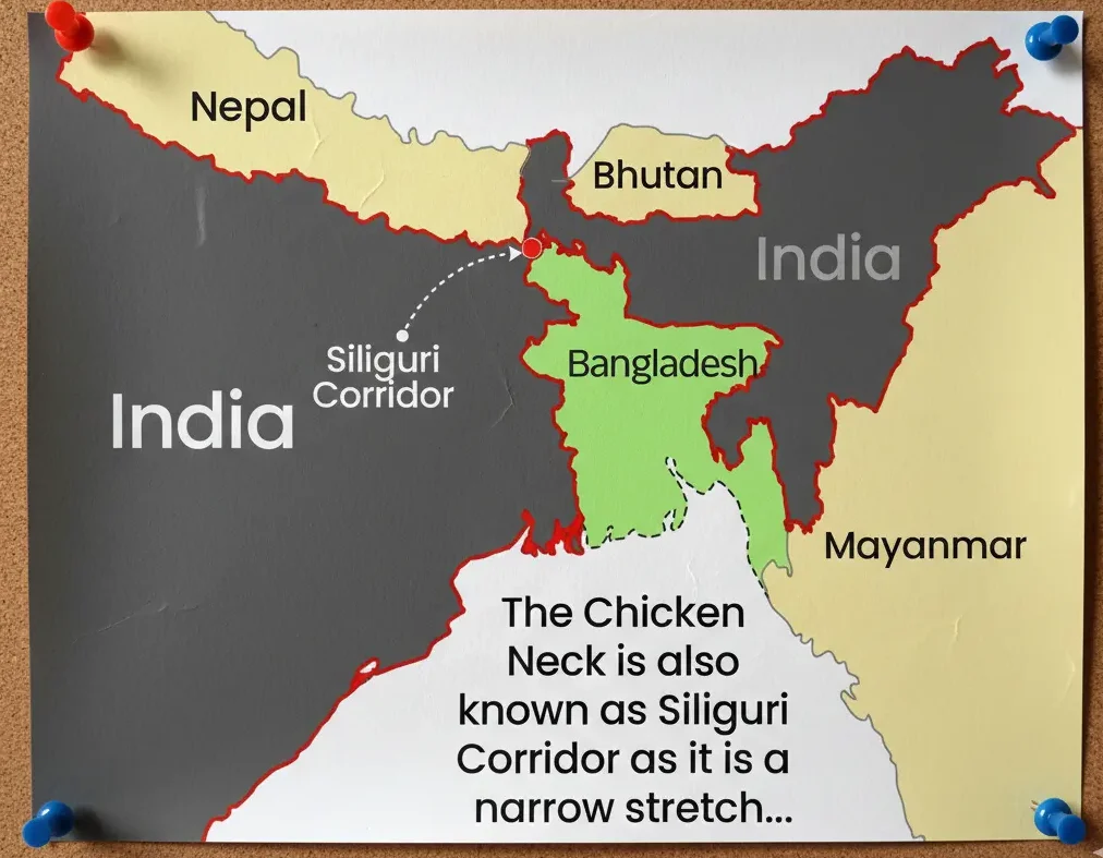
The Chicken Neck Corridor is a narrow strip of land located in northern West Bengal that connects mainland India with the eight northeastern states.
At its narrowest point, the corridor is only about 20–25 kilometres wide, making it one of the most sensitive geographical zones in the country.
This stretch lies between:
- Bangladesh on the south
- Bhutan on the north
- Nepal nearby to the west
Because of its thin shape, it resembles a chicken’s neck when viewed on a map, which led to its popular name.
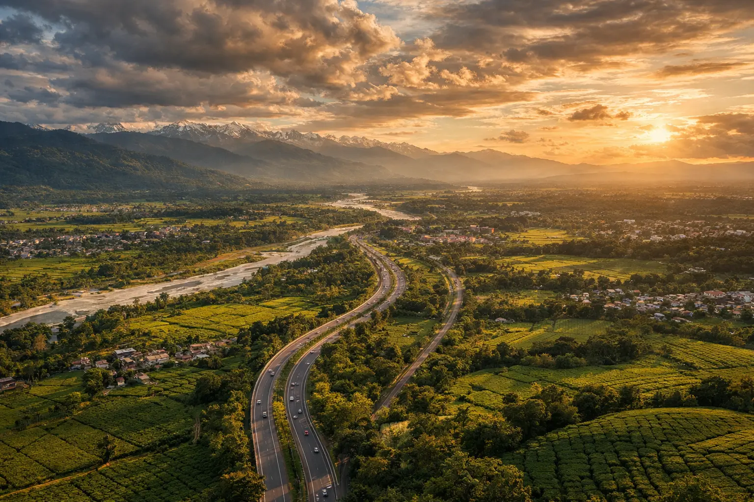
Where Exactly Is It Located?
The corridor is centered around the Siliguri region of West Bengal, which acts as the gateway to Northeast India.
Key locations within or near this area include:
- Siliguri city
- Jalpaiguri district
- Darjeeling foothills
- Major national highways and railway lines
Almost all road, rail, and supply routes to the Northeast pass through this zone.
Why Is the Chicken Neck Corridor So Important?
This corridor is the only land connection between mainland India and the northeastern states.
If this route were disrupted, the Northeast would become physically isolated from the rest of the country by land.
Its importance can be understood across multiple dimensions:
- National security and defence movement
- Trade and supply chains
- Passenger travel and tourism
- Emergency services and logistics
This single strip supports daily movement for over 45 million people living in the region.
Strategic and Defence Importance Explained Simply
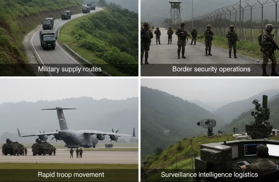
From a defence perspective, this corridor is extremely sensitive because of its proximity to international borders.
Any instability here could affect:
- Military supply routes
- Border security operations
- Rapid troop movement
- Surveillance and intelligence logistics
This is why the Indian government maintains heavy infrastructure development, security presence, and monitoring across the region without disturbing civilian life.
Historical Background You Should Know
Before India’s independence in 1947, the geography of eastern India looked very different.
After Partition:
East Pakistan (now Bangladesh) was created
Land access routes were drastically reduced
India retained this narrow passage as its only link
Since then, the corridor has remained strategically critical and politically sensitive, shaping decades of policy decisions and infrastructure planning.
Role in Trade, Transport, and Economy
Every truck, train, and bus carrying essential goods to the Northeast passes through this zone.
Major goods transported include:
- Fuel and cooking gas
- Food grains and vegetables
- Construction materials
- Medical supplies
Any delay here impacts prices, availability, and economic stability in northeastern states, making smooth operation essential.
Importance for Travelers and Tourists
For travelers, this corridor is unavoidable when visiting the Northeast by land.
If you’re planning trips to:
- Sikkim
- Assam
- Meghalaya
- Arunachal Pradesh
- Nagaland
- Manipur
- Mizoram
- Tripura
You will cross this region by road or rail, usually through Siliguri.
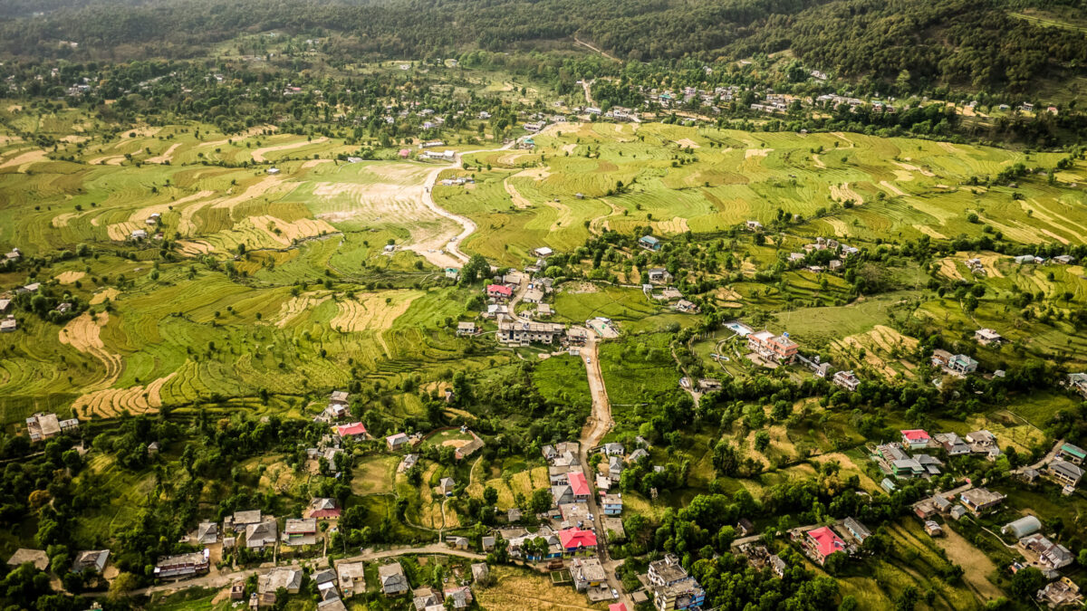
The area itself offers:
- Easy transport hubs
- Budget and premium hotels
- Access to Darjeeling, Kalimpong, and Dooars
- Tea gardens and forest routes
Is It Safe for Travelers?
Yes, the region is safe for tourists and everyday travelers.
Despite its strategic sensitivity, the chicken neck corridor functions like any normal transit zone with:
- Well-maintained highways
- Regular police and security patrols
- Busy railway junctions
- Civilian towns and markets
Travelers usually pass through without any special permits or restrictions unless entering border-sensitive zones.
Infrastructure Development in Recent Years
The government has invested heavily to strengthen connectivity and reduce dependency on a single route.
Major developments include:
- Highway expansion projects
- New railway lines
- Alternate routes through Bangladesh via agreements
- Improved border roads and bridges
These measures reduce pressure on the corridor while improving safety and efficiency.
Common Myths vs Reality
Many online discussions exaggerate risks related to this corridor.
Myths:
- The area is always under threat
- Tourists should avoid it
- Movement is restricted
Reality:
- It is a peaceful, functioning region
- Millions cross daily without issues
- It is vital, not dangerous
- Understanding facts helps reduce unnecessary fear.
Why This Corridor Matters for India’s Future
As India strengthens ties with Southeast Asia under its “Act East” policy, this region becomes even more crucial.
It supports:
- Regional integration
- Cross-border trade
- Tourism growth
- Cultural exchange
Rather than being a weakness, it is increasingly being transformed into a strategic advantage.
Final Thoughts
The Chicken Neck Corridor is not just a line on a map—it is a bridge between cultures, economies, and regions.
Understanding its geography, importance, and role helps travelers appreciate why this small stretch holds such massive national value, while still remaining accessible, peaceful, and essential to everyday life.
Frequently Asked Questions (FAQs)
- Why is it called the Chicken Neck Corridor?
Because its narrow shape on the map resembles a chicken’s neck connecting two larger land areas. - Which states depend on this corridor?
All eight northeastern states rely on it for land connectivity with mainland India. - Can tourists freely travel through this region?
Yes, normal travel through highways and railways is unrestricted and safe. - Is Siliguri part of the corridor?
Yes, Siliguri is the main urban hub within this critical stretch. - How wide is the corridor?
At its narrowest point, it is around 20–25 kilometres wide. - Are there alternative routes?
India is developing alternate trade and transit routes via Bangladesh to reduce dependence. - Does this area have tourist attractions?
Yes, nearby destinations include Darjeeling, Dooars, Kalimpong, and tea estates. - Is the corridor militarised?
Security presence exists, but civilian life functions normally without disruption.


1 thought on “7 Shocking Facts About the Chicken Neck Corridor That Connects Northeast India to the Rest of the Country”